The drone is the tool. The land is the subject.
Garden Route Aerial exists to make detailed aerial mapping practical and understandable for the people who own and manage land here - not just for organisations with a geospatial department.
Between a photographer and a survey firm.
There is a real gap between someone who takes lovely photographs from a drone and a geospatial consultancy that delivers a full conventional survey. Plenty of jobs need more than the first and less than the second.
Modern drones and photogrammetry software have made detailed aerial mapping accessible to property owners and businesses who would never previously have commissioned this kind of data. What has not become accessible is the ability to sit down with someone, describe a property in plain language, and get back something useful. That is the part we are trying to fix.
The proposition
Professional aerial mapping for people who need to understand land.
Substantially more technical than an aerial photography business. Considerably more approachable than a traditional geospatial consultancy.
Six things we try to be.
Precise
The output is spatial data, not just attractive pictures. It should hold up when someone measures against it within the limits we have stated.
Practical
You should understand exactly what you are receiving and why it is useful, before you commit to anything.
Technical
Photogrammetry is a genuinely sophisticated capability. The competence should show in the work rather than in the vocabulary.
Approachable
Nobody should need a GIS degree to talk to us. If we use a term that means nothing to you, ask - it is our fault, not yours.
Grounded
We will not exaggerate what drone mapping can determine. Being clear about the limits is what makes the rest of it trustworthy.
Local
We work the Garden Route specifically. Coming back for better light is a short drive, not a project cost.
The flight is data collection. The deliverable is the product.
You are not paying for an hour of drone operation. You are paying for planning, capture, processing, reconstruction, quality control, data preparation and delivery - and for someone to tell you honestly what the result is good for.
Anyone can fly over a farm and take photographs. Drones are cheap now, and getting cheaper. What is worth paying for is the workflow around them, and the judgement about when the data will actually answer your question.
This is the landscape we want to know.
Mountains meet the coast here. Properties run from coastal plots to forestry blocks to farms on serious slopes, and the weather can turn between one valley and the next.
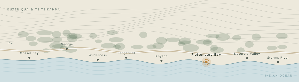
We would rather be the regional specialist who knows the ground than a national operation that treats the Garden Route as a travel line item. Based in Plettenberg Bay, working from Mossel Bay to Storms River, with exact coverage and travel confirmed per project.
Fly it. Capture it. Keep it.
Land looks different from above. Patterns appear, relationships become obvious, and thousands of individual photographs become something more useful than any single image: a map, a model, and a record you can compare against in ten years.
Tell us what you need to see.
Describe the property and what you are trying to understand about it. We will come back with how we would capture it, what you would receive, and what it costs.